


A detailed event course map is one of the most powerful tools a cyclist can carry into any race or gran fondo. It provides clear navigation, exposes hazards before you encounter them, reveals pacing zones across climbs and descents, and keeps you compliant with checkpoint rules even when your GPS dies. Organizations like the Adventure Cycling Association and professional cartographers at Underhill Race Maps have long set the standard for what a race-ready course map should deliver. Here is what every cyclist needs to know about why event course maps matter.
Core benefits at a glance:
- Navigation backup: A printed or downloaded map keeps you on course when digital devices fail.
- Pacing strategy: Elevation profiles show front-loaded versus back-loaded climbs so you can budget effort precisely.
- Hazard awareness: Marked danger zones, narrow sections, and technical descents let you pre-plan your line.
- Checkpoint compliance: Highlighted control points prevent missed turns and disqualification.
- Emergency response: Maps identify nearby towns for medical aid or bike repairs when you are off course.
Table of Contents
- Why course maps are the foundation of event route planning
- What map features every cyclist should understand
- How to use course maps for preparation and race-day navigation
- What experts and research say about course maps and cyclist safety
- Stay connected with the cycling community
- Key Takeaways
Why course maps are the foundation of event route planning
Understanding the structure of a cycling event route before race day separates riders who react from those who execute a plan. A well-designed map reveals far more than just the path from start to finish.
- Endpoints and segment complexity: The start, finish, and major route segments define your overall effort arc. Knowing where a long climb sits relative to the finish changes how aggressively you ride the first half.
- Elevation profiles: Gradient data shows not just where climbs occur but how steep and sustained they are. A 500-foot climb spread over five miles demands a different gear strategy than the same elevation over one mile.
- Aid stations and control points: Purpose-built routes balance challenge, safety, and logistical feasibility. Maps that clearly mark aid stations let you plan nutrition and hydration windows rather than guessing.
- Pacing zones: Flat stretches between climbs are recovery opportunities. Identifying them on the map before the gun goes off means you spend those miles actually recovering instead of pushing unnecessarily.
- Safety logistics: BRAG’s route planning guidance emphasizes that organizers build safety considerations directly into route design, including road width, traffic exposure, and surface quality. A good map communicates all of that visually.
- Professional cartography: Underhill Race Maps applies specialized cartographic standards to cycling events, removing visual clutter and emphasizing the details riders actually need at speed.
What map features every cyclist should understand
Not all course maps are created equal. The difference between a map that helps you race faster and one that gets you lost often comes down to a handful of design decisions.
- Standardized symbols: Aid stations, control points, hazard markers, and major turn indicators should follow consistent visual conventions so you can read them instantly at speed.
- Readability over detail: Overloaded maps increase rider distraction, raising the risk of falls and collisions. Simplified maps that prioritize essential information keep riders safer during fast sections.
- Elevation and terrain graphics: Color gradients or shaded relief showing climbs and descents give you a spatial sense of effort distribution across the full route.
- Route segmentation: Breaking the course into labeled segments helps you mentally chunk the event into manageable pieces rather than staring at one overwhelming line.
- Age-appropriate symbol sizing: Riders over 45 often need enlarged map symbols due to reduced close-distance legibility. Organizers who ignore this compromise both fairness and safety for a large portion of participants.
- Hazard overprinting: Danger points like steep descents, narrow road sections, and barrier locations should be visually distinct from standard route markings. The Adventure Cycling Association’s map feature standards address exactly this kind of layered visual communication.
- Scale accuracy: A map at too small a scale is nearly useless in the field. An extra sheet of paper costs nothing and can save hours of confusion.
Pro Tip: Before race day, print the course map at the largest readable scale and highlight control towns in a contrasting color. You will locate your position on the map far faster mid-ride than if you are scanning an undifferentiated line.
How to use course maps for preparation and race-day navigation
Many cyclists glance at the course map once and consider themselves prepared. Endurance coaches push back hard on that habit. Active map study before race day is one of the highest-value preparation tasks available, enabling you to plan nutrition, identify effort sections, anticipate tight corners, and choose your kit with real confidence.
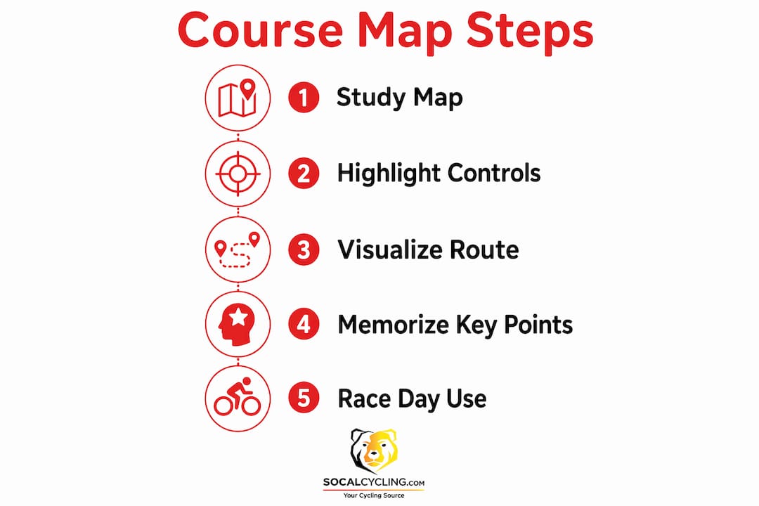
- Systematic pre-race study: Walk through the map segment by segment. Note where major climbs fall relative to total distance, where aid stations appear, and where technical sections demand extra attention.
- Load GPX files onto your head unit: GPS recordings alone are insufficient for precise event navigation. Plotted GPX files created with tools like RideWithGPS provide accurate junction and hazard data that ride-recorded files often miss.
- Weather and wind integration: Look at the map alongside the forecast. Knowing which segments face a likely headwind lets you set realistic power targets for those miles rather than blowing up chasing a pace that felt easy in training.
- Emergency navigation: If you crash, get dropped, or lose your device, a physical map tells you exactly where the nearest town is and which direction to ride. Control points marked clearly on the map make that decision fast.
- Recce rides: If the event allows pre-riding the course, use the map to identify the two or three sections that will most affect your race. Confirm road surfaces, junction visibility, and descent lines in person.
- Race rehearsal: Take your pacing plan, built from the elevation profile and segment data, and execute it on a local approximation of the course. About 75% of the race distance at target intensity gives you reliable feedback.
Pro Tip: Study the map the night before the event with your eyes closed after the first pass. Visualize the key moments: the first major climb, the technical descent, the final push to the finish. Mental rehearsal using mapped course details is free speed.
What experts and research say about course maps and cyclist safety
The case for detailed, accurate course maps goes well beyond convenience. Research and professional practice both point to maps as active safety infrastructure.
“A cue sheet alone cannot help a lost rider get back on course. A map allows riders to see where they’ve been and perhaps judge the terrain ahead. In emergencies, a map helps identify nearby towns where a rider might obtain medical aid or a bicycle.” — Randonneurs USA Route Preparation Guidance
A data-driven course evaluation methodology developed in partnership with the Union Cycliste Internationale uses geospatial analysis, computer vision, and machine learning to score road cycling courses for safety. The system highlights dangerous segments on a map, giving organizers and riders an objective view of where risk concentrates. Successful evaluations have already been completed for major professional races.
Route accuracy at the professional level is equally demanding. VeloViewer’s best-practice guidance for race organizers states that route files must be created by plotting rather than ride recording, because GPS recordings never follow the road to the accuracy needed for safe navigation at junctions, descents, and built-up areas. Files must be plotted using a tool like RideWithGPS to meet safety standards.

High-resolution aerial imagery has transformed how organizers build those maps. South Australia’s Super Series cycling events use MetroMap’s aerial tools to remotely inspect roads, measure barrier requirements, and plan complex urban courses without repeated site visits. That precision flows directly into the maps participants receive, making the course layout clearer and the event safer.
The readability research is equally direct. Poor map legibility forces riders to read for longer periods while moving, which increases fall and collision risk. Reducing visual clutter is not an aesthetic choice. It is a safety decision.
Stay connected with the cycling community

Socalcycling covers cycling events, race results, and rider preparation across Southern California and beyond. Whether you are lining up for your first gran fondo or targeting a competitive road race, Socalcycling keeps you informed with independent news, event category guides, and race coverage you can trust.
Key Takeaways
Detailed, accurate event course maps are active safety and strategy tools that directly affect how cyclists navigate, pace, and respond to hazards during events.
| Point | Details |
|---|---|
| Maps prevent navigation failure | A physical map keeps you on course when GPS devices fail and identifies nearby towns in emergencies. |
| Readability protects riders | Overloaded maps increase distraction and collision risk; simplified maps with clear symbols improve safety at speed. |
| Plotted GPX files outperform recordings | GPS ride recordings miss junction and hazard accuracy; plotted files using tools like RideWithGPS meet professional safety standards. |
| Active study beats passive glancing | Systematic pre-race map study lets you plan nutrition, pacing, and kit choices with real course data. |
| Aerial imagery improves map precision | High-resolution aerial tools allow organizers to measure courses remotely and allocate resources accurately, improving the maps riders receive. |
Recommended
- Cycling Event Category Guide: What Riders Need to Know
- Why Cycling Events Need Insurance: 2026 Guide
- Why Gravel Events Have Different Categories: 2026 Guide
- What Is a Cycling Passport Event? Your 2026 Guide