



Yes, California delivers world-class cycling across coastline, wine country, high mountains, and warm southern loops. The variety is real: think Pacific Coast Highway descents, the San Francisco Bay Trail’s flat miles, and Sierra climbs above 7,000 feet. Pick your region by terrain and skill level, then time your trip around spring or fall, since summer heat inland and winter snow at elevation both narrow the window.
TL;DR:
- Coastal routes like Highway 1 and the San Francisco Bay Trail are highly scenic but often interrupted by surface changes, gaps, and detours; check real-time conditions before rides.
- The Sierra Nevada offers challenging climbs above 6,000 feet with colder temperatures and thinner air, suitable for experienced riders prepared for altitude and variable weather.
- Timing your trip for spring or fall is ideal for coastal and Sierra routes, while Southern California can be ridden year-round, with summer inland heat and wildfire season requiring extra precautions.
- Route continuity varies across California’s main cycling routes, and local infrastructure quality significantly influences safety and rideability in different cities.
- Planning multi-day trips requires booking accommodations early, especially in remote regions like Big Sur and Tahoe, and incorporating bailout points for weather or fatigue.
Table of Contents
- What Makes Each Region Different for Cycling California
- What Should You Know About California’s Flagship Cycling Routes?
- Which Sample Routes Should You Try in Each Region?
- When Is the Best Time to Ride in California?
- How Do You Find Organized Rides and Events in California?
- What Do You Need to Handle for Logistics and Safety?
- How Should You Train and Gear Up for California’s Terrain?
- How Do You Plan a Multi-Day California Cycling Trip?
- Why Socalcycling’s Coverage of California Cycling Matters
- Put These California Cycling Resources to Work
- Where to Check Before You Ride
- Sources
What Makes Each Region Different for Cycling California
California doesn’t ride the same anywhere you go, and that’s the point. A century along Highway 1 has almost nothing in common with a flat spin around Lake Tahoe’s shoreline, and treating them the same way is how trips go sideways.
The Central and North Coast rewards riders who don’t mind wind. Highway 1 hugs cliffs with minimal shoulder in places, headwinds build by midday, and the nearest bike shop might be 40 miles off. Climb profiles here are punchy rather than sustained: short, steep pitches near river mouths, followed by flat stretches through farmland. Service towns like Cambria, Mendocino, and Fort Bragg break up the isolation, but riders should plan fuel stops carefully.
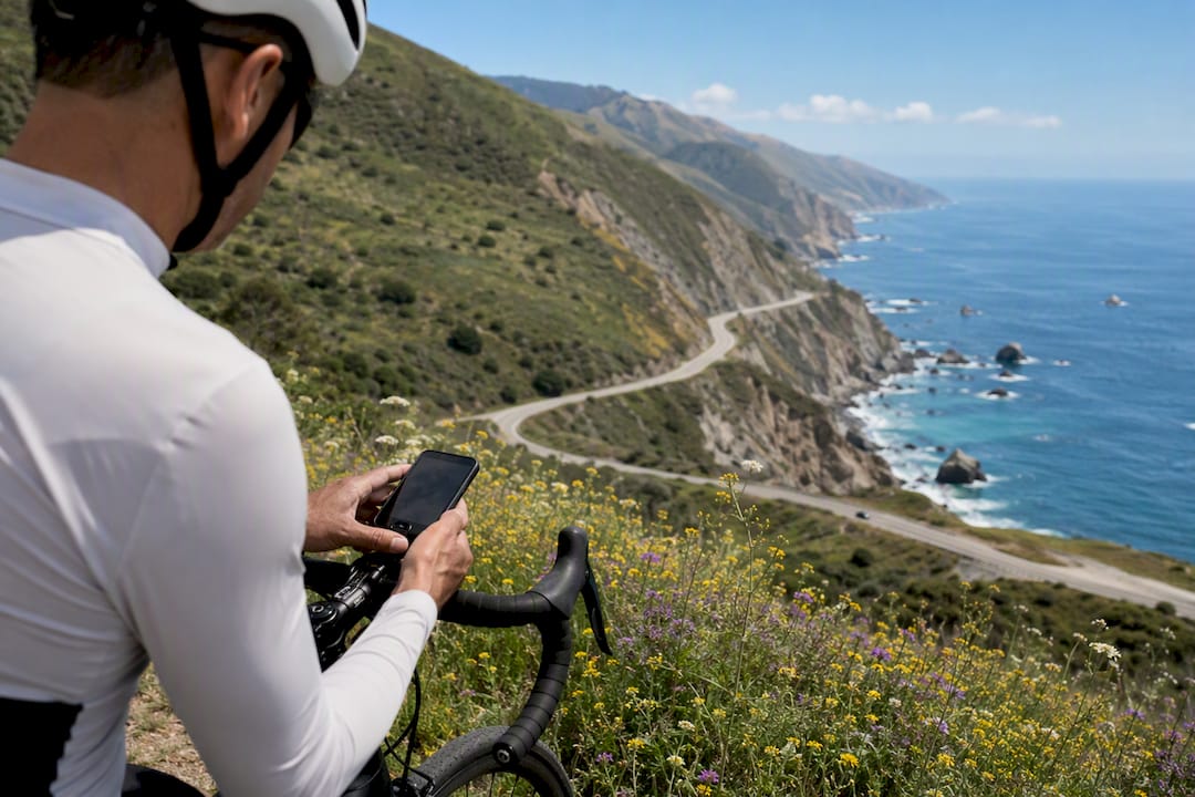
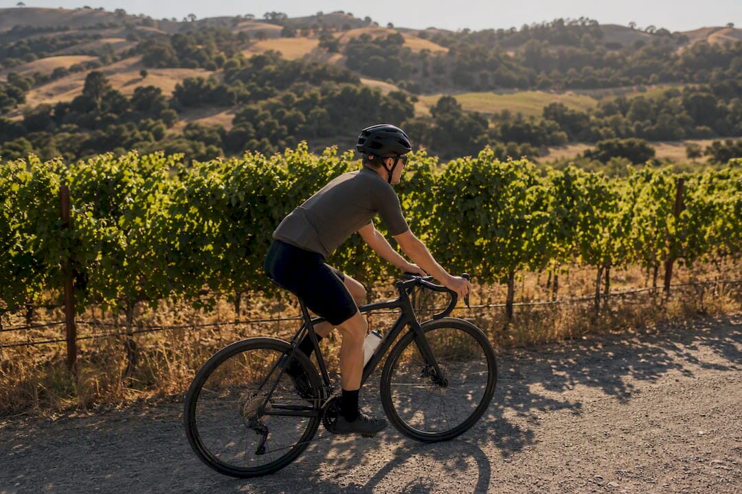
Wine Country (Napa, Sonoma, Santa Ynez) is the forgiving cousin. Rolling hills, wide shoulders, low traffic on back roads, and tasting rooms doubling as rest stops. This is where casual sightseers and social groups thrive, not where you go to suffer.
The Sierra Nevada is where climbers go to test themselves. Passes like Ebbetts, Monitor, and the roads circling Lake Tahoe gain thousands of feet over sustained grades, and altitude above 6,000 feet changes how your lungs and legs respond. Roads are generally well paved but narrow, and weather can turn fast even in July.
Southern California trades elevation for infrastructure. Los Angeles, Orange County, and San Diego offer extensive paved paths like the Santa Ana River Trail, dry weather most of the year, and a dense network of group rides. Traffic density is the main hazard rather than terrain.
The North Coast (Humboldt, Del Norte) is the wild card: fewer riders, more redwoods, unpredictable fog, and long gaps between services.
A useful way to sort all of this:
- Touring riders should target the coast or Wine Country for scenery paired with manageable logistics.
- Climbers belong in the Sierra, where the vertical gain is the reward.
- Gravel and rough-surface riders find variety on North Coast forest roads and inland Sierra fire trails.
- Casual sightseers do best in Southern California’s paved trail network or Wine Country’s flat loops.
Most of California’s long-distance cycling infrastructure is “braided,” meaning a single named route alternates between dedicated paths, painted bike lanes, and unprotected highway shoulder, sometimes block by block. That matters practically: don’t assume a route name guarantees a continuous, car-free surface. Bike-friendliness also varies enormously by city rather than by region alone. PeopleForBikes City Ratings show towns like Davis and Berkeley far ahead of statewide averages, while some cities along the very same coastal corridor lag badly on connected infrastructure. Rather than hunting for one “best” place to ride, match the city’s strengths to what you actually want to do there.
What Should You Know About California’s Flagship Cycling Routes?
Five routes come up in nearly every serious conversation about cycling California, and each one has quirks that catch first-timers off guard.
Highway 1 / Pacific Coast Highway is the route most people picture when they imagine California cycling. It runs the length of the coast, but “the route” is really a patchwork of scenic segments punctuated by high-traffic sections near cities. The Big Sur stretch between Cambria and Carmel is the marquee ride: roughly 90 miles of minimal shade, narrow shoulders, and views that make the effort worth it. Rockslide closures happen periodically, so checking Caltrans road status before committing to a multi-day Big Sur run isn’t optional.
The California Coastal Trail is the ambitious statewide project meant to eventually link the entire 1,230-mile coastline. A majority of it, well over half, is already built out, but it’s a genuinely braided system: paved paths in some counties, sidewalks in others, and stretches where cyclists share the highway shoulder with cars. The California Coastal Commission’s trail map is the one resource worth bookmarking before you plan a segment, since gaps aren’t always obvious from a standard map app.
The San Francisco Bay Trail is the most rider-friendly of the five in terms of continuity. It has 356 completed miles of mostly separated, paved path circling the Bay, linking cities, parks, and transit stops, and it’s eventually slated to exceed several hundred miles once finished. Long flat stretches along levees make it approachable for less experienced riders, though a few bridge crossings (the Golden Gate and Bay Bridge paths, in particular) have specific access hours and lane restrictions worth checking ahead.
The Lake Tahoe Loop circles the lake for about 72 miles, mixing dedicated bike paths on the California side with narrower highway shoulder sections, especially around the Nevada state line. Elevation sits above 6,200 feet the entire way, which means thinner air and colder mornings even in summer. Most riders split it into two days rather than pushing the full loop in one push.
The Santa Ana River Trail anchors Southern California’s paved-path scene. It currently runs about 30 miles from Huntington Beach inland, with grade-separated crossings at most major roads, making it one of the safer long rides in the region for families or anyone avoiding traffic entirely. Extensions are planned that could eventually stretch the corridor much further inland.
A few numbers worth keeping in mind while you plan:
- 875 miles of the Coastal Trail’s 1,230-mile target are already constructed.
- 356 miles of the Bay Trail are complete, with more than 500 miles planned at full build-out.
- 72 miles covers the full Lake Tahoe shoreline loop.
- 30 miles is the current length of the Santa Ana River Trail, with extensions in planning.
Route continuity is the recurring theme across all five: expect gaps, detours, and surface changes rather than one uninterrupted ribbon of pavement. For a deeper look at how these pieces connect on the ground, SoCalCycling’s route examples break down specific segments by terrain type.
Which Sample Routes Should You Try in Each Region?
Inspiration is easy. A rideable plan with real mileage numbers is harder to find, so here’s a starting list organized by region and ability level.
-
Cambria to Big Sur (Central Coast), about 60 miles with 3,500 feet of climbing, a full day for a fit rider. This stretch delivers the classic PCH cliffside experience with minimal urban interruption. Base out of Cambria, where bike shops can handle last-minute repairs, and book lodging in Big Sur well ahead since rooms are scarce.
-
Sonoma Valley Loop (Wine Country), roughly 35 miles with under 1,500 feet of gain, a half-day ride suited to intermediate and casual riders alike. Rolling terrain and light traffic make this a strong choice for groups with mixed fitness levels. Sonoma proper has rental shops and plenty of overnight options.
-
Lake Tahoe Full Loop (Sierra), about 72 miles with roughly 3,000 feet of elevation gain spread across the circuit, best tackled as an experienced rider’s single-day goal or a relaxed two-day trip. South Lake Tahoe offers the densest concentration of shops and lodging on the route.
-
Santa Ana River Trail, Huntington Beach to Yorba Linda (Southern California), around 28 miles one way, flat and fully paved, ideal for beginners or families wanting a car-free ride. Anaheim and Yorba Linda both have bike shops near trail access points, and the flat grade means almost anyone can finish it.
-
Davis Greenbelt Network (Sierra foothills / Central Valley), a flexible 10 to 20 mile loop through one of the most bike-integrated small cities in the country. Davis has more dedicated bike infrastructure per capita than almost anywhere else in the state, including the U.S. Bicycling Hall of Fame, and it’s a genuinely useful stop for riders who want a low-stress day mixed into a longer Sierra trip.
Each of these can be extended or shortened depending on daylight and fitness, but they’re built to be ridden as described, not aspirational sketches.
When Is the Best Time to Ride in California?
Timing is where most out-of-state visitors get California cycling wrong. Coastal routes ride best in spring (April to June) and fall (September to October), when marine fog burns off by mid-morning and afternoon winds haven’t fully kicked in yet. Summer along the coast means stronger prevailing winds from the northwest, so an early start beats fighting a headwind at 2 p.m.
The Sierra has a shorter window. Snow can linger on high passes into June, and the first storms of the season often arrive by late October, so July through September is the safe bet for anything above 6,000 feet. Winter closures at elevation aren’t a maybe, they’re expected: check pass status before planning any Tahoe-area ride outside summer.
Southern California rides nearly year-round, but summer heat inland (Inland Empire, desert-adjacent routes) can be brutal by midday.
A few seasonal notes worth building into your plan:
- Start rides early in the day across all regions to beat wind, heat, or both.
- Wildfire smoke season, typically August through October in Northern California, can degrade air quality enough to cancel a planned climb. Check air quality index readings, not just the forecast.
- Wine Country and Southern California stay rideable through winter, making them good fallback regions if a Sierra trip gets rained or snowed out.
How Do You Find Organized Rides and Events in California?
If you’d rather ride with support and company than solo it, California’s event calendar runs deep. Knowing the difference between event types keeps you from signing up for something that doesn’t match your goals.
A gran fondo is a mass-participation ride, timed but not raced in the traditional sense, usually 60 to 100 miles with full aid station support and a festival atmosphere at the finish. A century is simply a 100-mile ride, sometimes competitive, often just a personal challenge with rest stops along the way. Audax rides (also called brevets) are longer, self-supported endurance events with strict time limits, aimed at riders chasing distance over speed. Criteriums are short, fast, closed-course races in urban settings, more spectator sport than scenic tour, and a good entry point if you’re curious about racing without committing to a road race’s distance.
Picking the right event comes down to matching distance and support level to your fitness and goals rather than picking the biggest name on the calendar. Tourofcalifornia catalogs gran fondos, centuries, and other organized rides statewide, and it’s worth scanning by region before locking in travel dates.
A few patterns worth knowing:
- Spring and fall see the heaviest gran fondo and century calendar, mirroring the same weather windows that favor coastal and Sierra riding.
- Criteriums cluster in metro areas and run more consistently through summer since they don’t depend on remote road conditions. SoCalCycling’s guide to Southern California criterium races is a solid starting point.
- Cyclocross season shifts the calendar toward fall and winter; SoCalCycling’s cyclocross event roundup covers the state’s key races.
- If group riding year-round appeals to you more than a single event, finding a local cycling group is often the better long-term move.
What Do You Need to Handle for Logistics and Safety?
The riding is the fun part. Getting your bike, body, and gear to the start line intact is where trips actually succeed or fail.
Lodging and rentals. Bike-friendly lodging means secure indoor storage, not just a bell captain who’ll “keep an eye on it.” Call ahead and ask specifically whether they’ve hosted cyclists before, especially in smaller coastal towns where rooms fill fast during peak season. If you’re not flying with your own bike, contact a local shop directly for rental availability and ask about insurance coverage and mileage limits.
Getting your bike there. Flying with a bike means choosing between a hard case (better protection, heavier, harder to store once you arrive) and a soft travel bag (lighter, cheaper, requires more careful packing). Airline bike fees vary and change often, so check your specific carrier’s current policy before booking rather than assuming last year’s rate still applies.
Checking route status before you go. Coastal routes, Big Sur especially, are prone to closures from landslides and construction. Check Caltrans QuickMap for real-time road status, the California Coastal Trail map for segment continuity, and local county trail pages for anything Bay Trail or Santa Ana River Trail related. A route that was rideable last season isn’t guaranteed to be open now.
Safety basics that matter more in California than in most places:
- Wear a helmet. California doesn’t mandate helmets for adult cyclists statewide, but riders under 18 are required to wear one, and every serious rider wears one regardless of age.
- Run front and rear lights even on daytime rides through fog-prone coastal stretches.
- Check wildfire and air quality alerts before any ride in fire season, particularly inland and Sierra routes.
- Carry a charged phone and know where cell coverage drops out, especially through Big Sur and remote Sierra passes.
Pro Tip: Download offline maps for any coastal or Sierra route before you leave cell coverage. Big Sur alone has multiple dead zones where a live map is useless exactly when you need it most.
How Should You Train and Gear Up for California’s Terrain?
California’s mix of flat coastal miles and sustained Sierra climbs demands a training approach that covers both endurance and power, not one or the other. The 75% rule is the framework most coaches lean on for exactly this kind of trip: roughly 75% of your weekly training time stays in low-intensity Zone 1 to 2, with the remaining 25% dedicated to harder efforts. Track it by minutes, not miles, using a heart-rate monitor or power meter, since a flat 30-mile spin and a hilly 30-mile climb take wildly different physiological tolls.
The 75/25 split builds the aerobic base that lets you survive a five-hour coastal day, while the harder 25% builds the punch you’ll need on a Sierra pass. Skip one side of that ratio and the other suffers when it counts.
For gear, tire choice matters more on California’s mixed surfaces than most riders expect. A 28 to 32mm tire is a practical middle ground for coastal routes with rougher chip-seal pavement and occasional wind gusts, offering better rolling comfort without sacrificing much speed. Sierra climbs favor a wider gear range, a compact crank or a mid-cage rear derailleur setup handles sustained double-digit grades far better than a standard road gearing setup.
A few training and gear notes worth locking in before a big trip:
- Practice climbing at altitude if you can, since Sierra routes above 6,000 feet tax your lungs differently than sea-level training rides.
- Fuel proactively on long coastal days: wind resistance burns more energy than flat-road math suggests.
- Pace conservatively on the first Sierra climb of a trip until you know how your body responds to elevation.
- For riders building a structured plan around a big event, SoCalCycling’s strength training program for cyclists pairs well with the 75% endurance framework.
How Do You Plan a Multi-Day California Cycling Trip?
Turning inspiration into an actual itinerary is where most trip plans stall. Here’s a simple template scaled to three time frames.
-
3-day trip: Day 1, Cambria to Big Sur (60 miles, book lodging weeks ahead). Day 2, Big Sur to Carmel (30 miles, shorter day to enjoy the coastline). Day 3, Carmel loop or return transfer. This compresses the marquee coastal experience into a long weekend.
-
5-day trip: Add a Wine Country segment before or after the coast. Day 1 to 3 mirror the coastal plan above; Day 4 transfers to Sonoma for a 35-mile valley loop; Day 5 is a rest and recovery day with optional short ride. Luggage transfer services exist in both regions and are worth booking two to three weeks out during peak season.
-
7-day trip: Combine coast, Wine Country, and a Sierra finale. Days 1 to 5 follow the 5-day template; Days 6 and 7 shift to South Lake Tahoe for the full 72-mile loop, split across two days to account for altitude adjustment.
Resupply is rarely a problem on the coast or in Wine Country, but Sierra days require carrying more water and calories than flat-terrain habits suggest. Book Big Sur and Tahoe lodging well in advance regardless of season, since both regions have limited room inventory relative to demand.
Build in a bail point for every day, a nearby town with transit or a shuttle option, in case weather, a mechanical issue, or simple fatigue forces a shorter day. Coastal fog delays and Sierra afternoon thunderstorms are the two most common reasons riders cut a day short, and having an exit planned beats improvising one on the shoulder of Highway 1.
Why Socalcycling’s Coverage of California Cycling Matters
Socalcycling has spent years covering road racing, mountain biking, gravel, cyclocross, and gran fondos across Southern California and beyond, and that ground-level reporting shapes how we think about trip planning versus how a generic travel guide might. We’ve watched event calendars shift season to season, tracked which routes actually hold up to real traffic and construction, and talked to enough riders to know that the gap between a route’s reputation and its current condition is often wider than people expect.
That’s the lens behind this guide: practical, current, and grounded in what riders actually encounter on the road. For ongoing race coverage, event calendars, and regional route reporting, Socalcycling’s event and news hub stays updated as the season unfolds, and it’s worth checking back before you lock in any trip.
— SoCalCycling.com
Put These California Cycling Resources to Work
Planning a multi-day trip or a first big event takes more than a route map, and Socalcycling has spent years building the exact resources that fill the gaps: event logistics, training structure, and calendar tools that generic travel guides simply don’t cover.

If you’re organizing group rides or considering what it takes to run an event yourself, Socalcycling’s breakdown of the race director role walks through the behind-the-scenes logistics that make an event work smoothly. Riders building toward a big Sierra climb or a long coastal push will get more out of a structured plan than winging it, and the 12-week strength training program pairs directly with the 75% endurance framework covered above. And if scenic detours matter as much as the ride itself, Southern California’s regional sightseeing guide is worth a look for stops worth adding to your route. Start with whichever resource matches your next trip, and check the race director guide first if an event is on your calendar this season.
Where to Check Before You Ride
Route conditions change faster than any guide can track, so bookmark these before your trip. The California Coastal Commission’s trail map shows current Coastal Trail segment status and gaps. PeopleForBikes City Ratings helps you compare infrastructure quality city by city if you’re choosing a home base. TourOfCalifornia.org remains the best single catalog of statewide gran fondos, centuries, and organized rides. For Bay Area riders, the San Francisco Bay Trail overview covers current mileage and planned extensions worth checking before a Bay Trail day.
Sources
- California cities with the best and worst bike networks — California Bicycle Coalition
- California Coastal Trail — California Coastal Commission
- San Francisco Bay Trail — Wikipedia
- Pedal power in Davis — Visit Davis
- Tourofcalifornia
Recommended
- California Cycling Route Examples for Every Terrain
- Types of Gran Fondo Events in California: 2026 Guide