


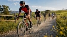
California is the most terrain-diverse cycling state in the country, offering california cycling route examples that range from 22-mile flat coastal paths to 102-mile mountain endurance races. The Marvin Braude Bike Trail, Alpine Dam Loop, and Mammoth Gran Fondo represent just three points on a spectrum that also includes wine country vineyard loops, remote northern forest tracks, and urban recreational paths. Whether you are planning a weekend ride, building a training block, or scouting an event course, California delivers terrain for every goal and every fitness level.
1. What are the best California cycling route examples by terrain?
The state’s best rides divide cleanly into five terrain categories: coastal, mountain, wine country, northern wilderness, and urban. Each category demands different fitness, gear, and timing. Knowing which category fits your goal is the fastest way to narrow down your options from hundreds of mapped routes.
Coastal routes suit recreational riders and beginners. Mountain routes reward climbers and endurance athletes. Wine country loops offer moderate challenges with exceptional scenery. Northern wilderness routes are reserved for experienced riders with navigation skills. Urban trails work for commuters, families, and anyone building base miles.
2. Marvin Braude Bike Trail: California’s most accessible coastal ride
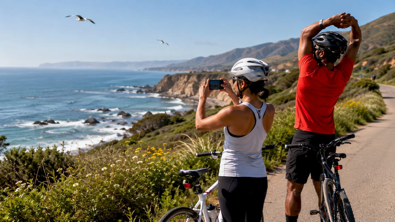
The Marvin Braude Bike Trail is a 22-mile flat path running along the Los Angeles coastline from Pacific Palisades to Torrance Beach. It is the most accessible coastal ride in Southern California, with zero significant elevation gain and a dedicated bike lane separated from vehicle traffic. Families, commuters, and recreational riders all use it year-round.
The trail passes through Santa Monica, Venice Beach, Manhattan Beach, and Hermosa Beach. Each section has restrooms, food vendors, and easy exit points. For cyclists building aerobic base miles, two or three laps of the full trail provide a solid low-intensity workout without the hazards of open roads.
Pro Tip: Ride the Marvin Braude trail before 9 a.m. on weekends. Foot traffic from tourists and beachgoers peaks between 10 a.m. and 2 p.m. and makes the path genuinely difficult to navigate at speed.
3. Monterey Bay Coastal Recreation Trail: 18 miles of ocean views
The Monterey Bay Coastal Recreation Trail runs 18 miles along the Monterey Bay shoreline, connecting Pacific Grove to Castroville. The path is paved, mostly flat, and separated from vehicle traffic for the majority of its length. It is one of the most photographed cycling paths in California because of the unobstructed ocean views throughout.
The Cannery Row section near downtown Monterey is the most congested stretch. Riders targeting a clean training effort should start from the Pacific Grove end and head north, where foot traffic drops significantly. The trail connects to several road cycling routes heading inland toward Carmel Valley, making it a natural starting point for longer mixed-terrain days.
4. Pacific Coast Highway segments: planning by section, not by full route
Pacific Coast Highway cycling is best approached as a series of distinct segments rather than one continuous route. Each section carries different traffic volumes, shoulder widths, and elevation profiles. Treating the full PCH as a single ride leads to poor preparation and real safety risks.
The Big Sur section between Carmel and San Simeon is the most dramatic and the most demanding. The road narrows significantly, with steep cliffs on one side and ocean on the other. The Santa Barbara section from Ventura to Gaviota is far more forgiving, with wider shoulders and lighter traffic. Weekday morning rides dramatically reduce vehicle exposure on both segments.
| PCH Segment | Distance | Difficulty | Key Feature |
|---|---|---|---|
| Big Sur (Carmel to San Simeon) | ~90 miles | Advanced | Cliff-side roads, narrow shoulder |
| Santa Barbara (Ventura to Gaviota) | ~40 miles | Intermediate | Wide shoulder, coastal views |
| Malibu (Santa Monica to Oxnard) | ~35 miles | Beginner | Accessible, moderate traffic |
5. Alpine Dam Loop: the benchmark climb in Marin County
The Alpine Dam Loop is 52.9 miles of rolling and climbing terrain in Marin County, north of San Francisco. It is the standard benchmark ride for Bay Area road cyclists testing their climbing fitness. The route circles Alpine Lake through Mount Tamalpais State Park, with sustained climbs and technical descents that demand full attention.
The climb up Bolinas Road to Alpine Dam is the defining feature. Grades are consistent but not extreme, making it a strong choice for cyclists building climbing endurance before tackling harder mountain routes. The descent back toward Fairfax is fast and technical. Riders unfamiliar with the road should brake early and stay wide on the corners.
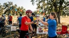
6. Mammoth Gran Fondo: California’s premier endurance cycling event
The Mammoth Gran Fondo is a 102-mile organized ride based in Mammoth Lakes, with total elevation gain that places it among the hardest gran fondos in the western United States. The route climbs through the Eastern Sierra Nevada at altitude, which adds physiological stress beyond what the distance alone suggests. Riders who have not trained at elevation often underestimate the effort required.
The event format makes it accessible to cyclists who want a supported endurance challenge. Aid stations, mechanical support, and marked roads reduce the logistical burden. For cyclists using the sportive format to test fitness before racing season, Mammoth Gran Fondo is one of the most effective options in California.
Pro Tip: Arrive in Mammoth Lakes at least two days before the ride. Altitude acclimatization at 8,000 feet takes 48–72 hours and directly affects your power output and recovery on the day.
7. Reds Meadow Ride: 28 miles through volcanic terrain
The Reds Meadow Ride covers 28 miles with 3,000 feet of elevation gain through the Mammoth Lakes Basin and into the Reds Meadow Valley. The route passes the Devils Postpile National Monument and Rainbow Falls, two geological landmarks that make the ride as visually rewarding as it is physically demanding. The road is closed to private vehicles during peak season, which means cyclists have the pavement largely to themselves.
The climb out of Mammoth Lakes is relentless for the first 10 miles. Riders who pace conservatively on the ascent are rewarded with a long, smooth descent back into the basin. This route pairs well with a rest day in Mammoth Lakes before or after the Mammoth Gran Fondo.
8. California National Forest trails: mountain biking at scale
California National Forests contain 5,779 trail segments covering approximately 8,590 miles, with 443 segments open to mountain biking. That scale means the state’s national forest system is one of the largest legal mountain biking networks in the country. Most riders never explore more than a fraction of what is available.
The Tahoe National Forest, Angeles National Forest, and Los Padres National Forest each offer distinct trail characters. Tahoe trails are high-altitude and technical. Angeles trails near Los Angeles are accessible but rocky. Los Padres trails in the Santa Barbara backcountry are remote and physically demanding. Checking the Motor Vehicle Use Map (MVUM) for each forest before riding is mandatory, as trail access changes seasonally and after storm damage.
9. Tour of Santa Ynez and Foxen Canyon: wine country cycling loops
Wine country cycling in the Santa Ynez Valley offers two clear options based on fitness level. The Tour of Santa Ynez is a 10–15 mile easy loop through flat vineyard roads, ideal for recreational riders or those combining cycling with wine tasting. Foxen Canyon is a 35–45 mile challenging ride with rolling hills and significant climbing through the northern valley.
Local knowledge transforms both routes. The back lanes running parallel to Highway 246 carry a fraction of the vehicle traffic and pass directly through working vineyards. Riders who stick to the main highway miss the best scenery and face unnecessary traffic risk. Timing matters too. Weekend afternoons bring heavy tourist traffic to the valley. Weekday mornings are the correct choice for both safety and enjoyment.
- Tour of Santa Ynez: 10–15 miles, flat, beginner-friendly, vineyard views throughout
- Foxen Canyon Road: 35–45 miles, rolling hills, moderate to challenging, low traffic on back lanes
- Ballard Canyon: Short connector loop, steep grades, exceptional views of the Santa Ynez Mountains
- Refugio Road: Climbs from the valley floor to the Santa Ynez Mountains, advanced riders only
10. Lost Coast BDR-X: 500 miles for advanced northern California riders
The Lost Coast BDR-X is a 500-mile figure-eight loop in northern California, divided into five sections covering forest roads, coastal tracks, and remote wilderness terrain. It is the most demanding cycling adventure route in the state and is designed for experienced riders with bikepacking or gravel touring experience. Cell coverage is absent across large sections of the route.
Northern coastal routes in this region require advanced skills because surface conditions change dramatically with weather. Mud, loose gravel, and washed-out sections are common outside the summer window. Checking MVUM maps and local ranger station alerts before departure is not optional. Riders who skip this step risk being stranded on closed roads with no support.
“The Lost Coast BDR-X is not a route you improvise. Seasonal closures, remote terrain, and variable surfaces demand thorough pre-ride research and self-sufficiency.” — Bike Travel Adventures Magazine
11. Sonora Pass (Highway 108): the steepest paved climb in California
Sonora Pass on Highway 108 features grades up to 26% on the eastern approach, making it the steepest sustained paved climb available to road cyclists in California. The descent on the western side is equally demanding, with tight switchbacks that require confident braking and precise line selection. This is not a route for cyclists who have not practiced technical descending.
Specialized gear is required for Sonora Pass. Compact cranks and wide-range cassettes are standard recommendations. Riders using standard gearing will grind to a halt on the steepest pitches. The pass is closed by snow from approximately november through may, so the riding window is limited to late spring through early fall.
For cyclists finding gravel races or events that incorporate high-altitude passes, Sonora Pass training rides provide excellent preparation for the physical and technical demands of Sierra Nevada event courses.
Key takeaways
California’s best cycling routes reward riders who match terrain type to their fitness level, timing, and specific goals before they clip in.
| Point | Details |
|---|---|
| Coastal routes for all levels | Marvin Braude and Monterey Bay trails offer flat, accessible rides with minimal traffic risk. |
| Mountain routes demand preparation | Alpine Dam Loop and Mammoth Gran Fondo require climbing fitness and altitude acclimatization. |
| Wine country needs local knowledge | Back lanes in Santa Ynez reduce traffic and deliver better scenery than main roads. |
| Northern routes require advanced skills | Lost Coast BDR-X and Sonora Pass demand technical ability, specialized gear, and pre-ride research. |
| National forest trails are underused | California’s 443 mountain bike trail segments across 8,590 miles offer far more variety than most riders realize. |
Our take on choosing California routes that actually fit your goals
California’s route variety is genuinely exceptional, but that variety creates a real problem for riders who approach it without a clear framework. We see it every season. Riders show up to the Mammoth Gran Fondo undertrained for altitude, or they tackle the Lost Coast BDR-X without checking seasonal closures, or they ride PCH through Big Sur on a Saturday afternoon and spend the whole day dodging RVs.
The routes themselves are not the issue. The mismatch between rider preparation and route demands is the issue.
Our honest recommendation is to treat terrain type as your first filter, not distance. A 30-mile mountain ride at altitude is harder than a 60-mile coastal flat. A 40-mile wine country loop on back lanes is more enjoyable than a 20-mile stretch on Highway 246 at noon on a Sunday. Distance is a secondary variable.
The second thing we consistently recommend is timing. Weekday mornings on popular routes like Big Sur and Santa Ynez are categorically safer and more enjoyable than weekend afternoons. That single scheduling decision changes the character of the ride entirely.
We also advocate strongly for the underexplored routes. The national forest trail network, the Mammoth Lakes Basin loops, and the northern coastal routes get a fraction of the attention that PCH and Marin County receive. That means less traffic, better surfaces in many cases, and a more genuine adventure. If you have been riding the same coastal path for two years, it is time to look at what California’s forests and mountain passes actually offer.
Explore California cycling with Socalcycling
Socalcycling covers the full spectrum of California cycling, from gran fondo event previews and race results to local group ride guides and gravel route features. If you are planning your next ride or looking for an event to target, the Socalcycling event calendar and news feed keep you connected to what is happening across the state.

Whether you are a road racer scouting your next training block, a gravel rider building toward an event, or a recreational cyclist looking for a new weekend route, Socalcycling.com is your central resource for California cycling news, event calendars, and community coverage. Check the site regularly for updated route features, race previews, and athlete stories from across Southern California and beyond.
FAQ
What is the easiest cycling route in California for beginners?
The Marvin Braude Bike Trail in Los Angeles is the most beginner-friendly option, covering 22 flat miles along the coast with a dedicated lane and no significant elevation gain.
How long is the Alpine Dam Loop in Marin County?
The Alpine Dam Loop is 52.9 miles with significant elevation gain, making it a benchmark climb for Bay Area road cyclists and a strong intermediate training route.
When is the best time to ride Pacific Coast Highway?
Weekday mornings are the safest and most enjoyable time to ride PCH segments, particularly through Big Sur and Santa Barbara, where weekend traffic on narrow roads creates real hazards.
How many mountain biking trails are in California’s national forests?
California National Forests contain 5,779 trail segments across approximately 8,590 miles, with 443 segments legally open to mountain biking across forests including Tahoe, Angeles, and Los Padres.
Is the Lost Coast BDR-X suitable for intermediate cyclists?
The Lost Coast BDR-X is a 500-mile advanced route with remote terrain, seasonal closures, and no cell coverage across large sections. It is designed for experienced riders with bikepacking skills and thorough pre-ride research.
Recommended
- Cycling Sportive Explained: Your Complete Ride Guide
- Gravel Race Event Examples Across the United States
- Why Cycling Events Have Rest Stops: A Rider’s Guide
- SoCalCycling.com | California Cycling Events, News and Racing


